Radio Activity 10-16 Feb 2025
Categories: Radio
It’s been quite the week of radio related nonsense for me, where I’ve been channelling my time and brainspace for radio into activity on air and system refinements, not working on Debian.
POTA, Antennas and why do my toys not work?
Having had my interest piqued by Ian at mastodon.radio, I looked online and spotted a couple of parks within stumbling distance of my house, that’s good news! It looks like the list has been refactored and expanded since I last looked at it, so there are now more entities to activate and explore.
My concerns about antennas noted last week rumbled on. There was a second strand to this concern too, my end fed 64:1 (or 49:1?!) transformer from MM0OPX sits in my mind as not having worked very well in Spain last year, and I want to get to the bottom of why. As with most things in my life, it’s probably a me problem.
I came up with a cunning plan - firstly, buy a new mast to replace the one I broke a few weeks back on Cat Law.
Secondly, buy a couple of new connectors and some heatshrink to reterminate my cable that I’m sure is broken.
Spending more money on a problem never hurt anyone, right?
Come Wednesday, the new toys arrived and I figured combining everything into one convenient night time walk and radio was a good plan.
So I walk out to the nearest park with my LoRa APRS doofer going and see what happens:
After circling a bit to find somewhere suitable (there appear to be construction works in the park!) I set up my gear in 2C with frost on the ground, called CQ, spotted and got nothing on either the end fed half wave or the cheap vertical.
As it was too late for 20m, I tried 40 and a bit of 80 using the inbuilt tuner, but wasn’t heard by stations I called or when calling independently.
I packed everything up and lora-doofered my way home, mildly deflated.
Try it at home
It still didn’t sit with me that the end fed wasn’t working, so come Friday night I set it up in the back garden/woods behind the house to try and diagnose why it wasn’t working.
Up it went, I worked some Irish stations pretty effortlessly, and down everything came. No complaints - the only things I did differently was have the feedpoint a little higher and check my power, limiting it to 10W. The G90 can do 20W, I wonder if running at that was saturating the core in the 64:1.
At some point in the evening I stepped in some dog’s shit too, and spent some time cleaning my boots outside to avoid further tramping the smell through the house.
Win some, lose some.
Take it to the Hills
On Friday, some of the other GM-ES Sota-ists had been out for an activity day.
On account of me being busy in work, I couldn’t go outside to play, but I figured a weekend of activity was on the books.
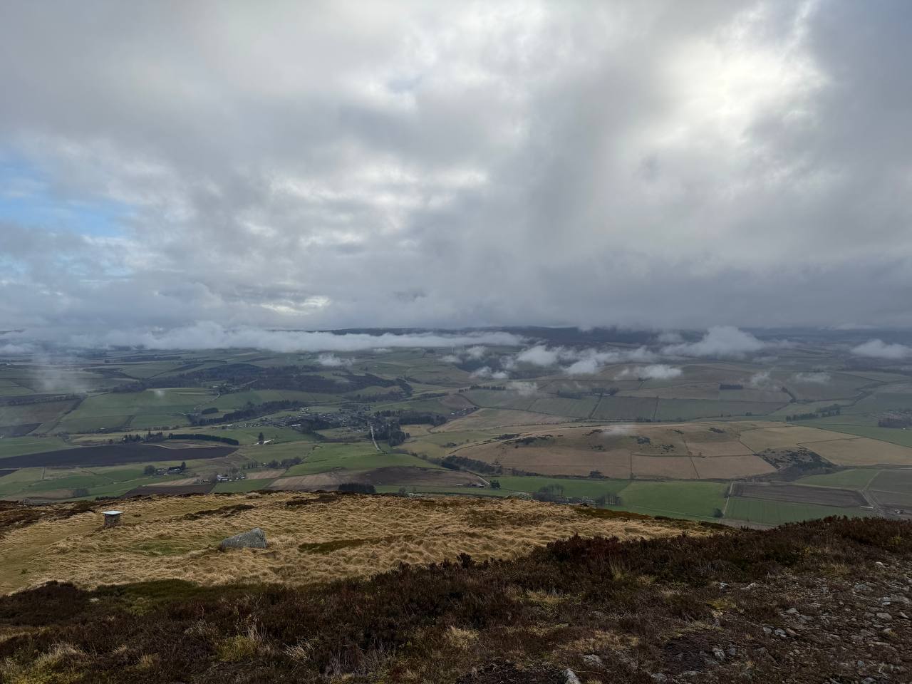
Saturday - A day above the clouds
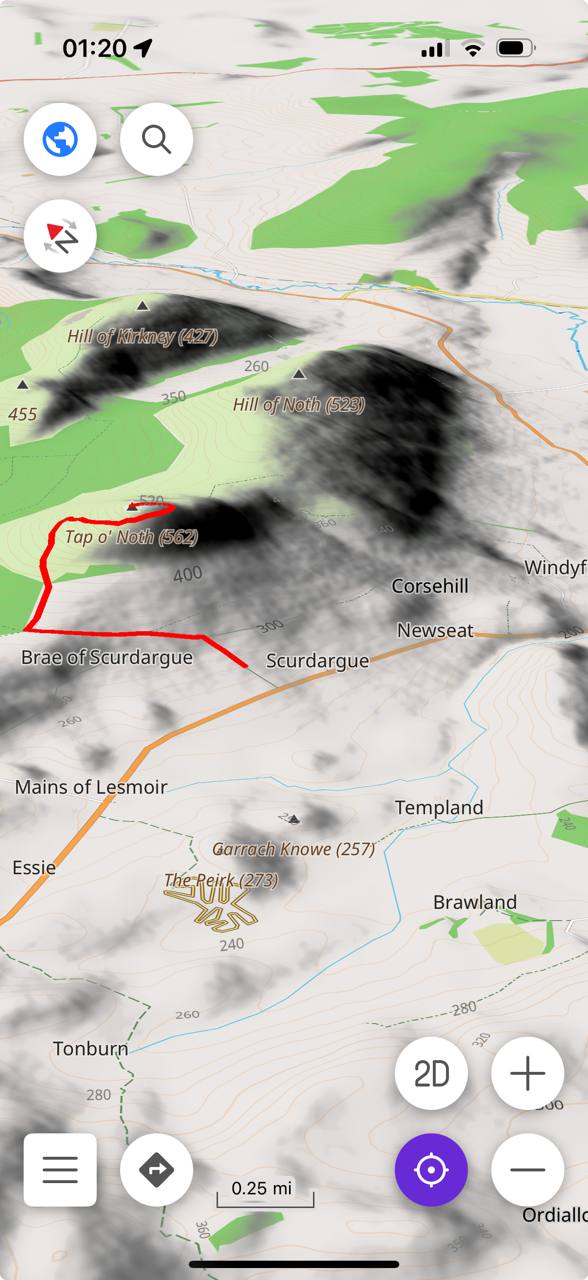
On Saturday I took myself up Tap O’ Noth, a favourite of mine for some reason, and Lord Arthur’s Hill.
Before I hit the hills, I took myself to the hackerspace and printed myself a K6ARK Winder and a guy ring for the mast, cut string, tied it together and wound the string on to the winder.
I also took time to buzz out my wonky coax and it showed great continuity. Hmm, that can be continued later. I didn’t quite get to crimping the radial network of the Aliexpress whip with a 12mm stud crimp, that can also be put on the TODO list.
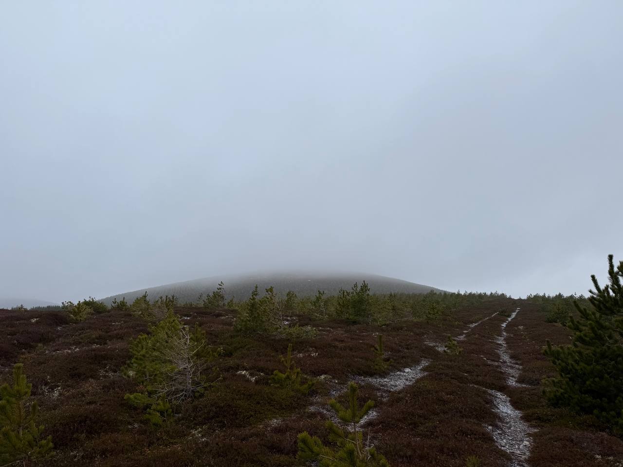
Tap O’ Noth
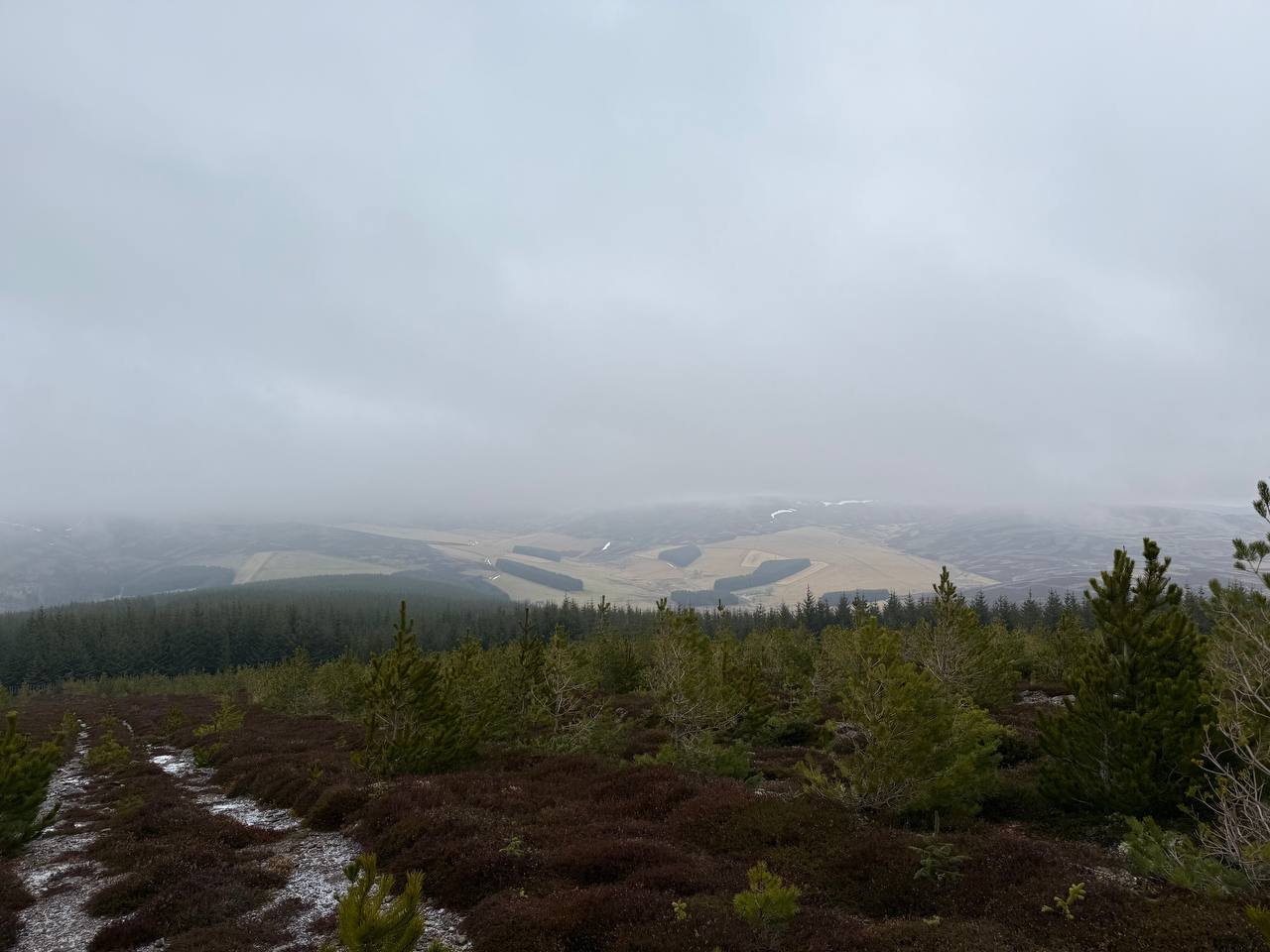
Once finally out, the weather was a bit cloudy with passing snow showers, but in between the showers I was above the clouds and the air was clear:
After a mild struggle on 2m, I set up the end fed the first hill and got to work from the old hill fort:
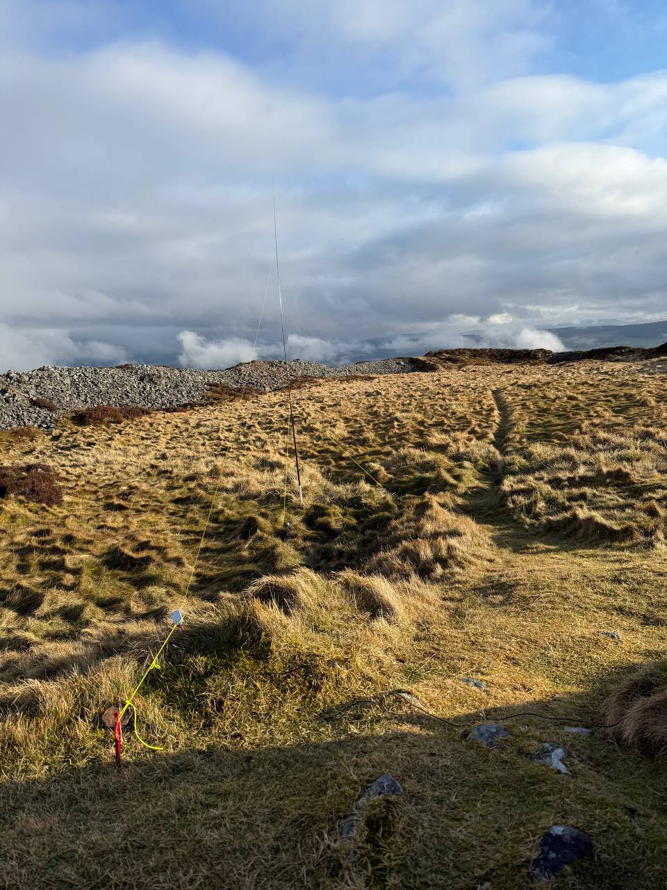
The end fed worked flawlessly. Exactly as promised, switching between 7MHz, 14MHz, 21MHz and 28MHz without a tuner was perfect, I chased hills on all the bands, and had a great time. Apart from 40m, where there was absolutely no space due to a contest. That wasn’t such a fun time!
My fingers were bitterly cold, so on went the big gloves for the descent and I felt like I was warm by the time I made it back to the car.
It worked so well, in fact, I took the 1/4 wave cheap vertical out my bag and decided to brave it on the next activation.
Lord Arthur’s Hill
GM5ALX has posted a .gpx to sotlas which is shorter than the other ascent, but much sharper - I figured this would be a fun new way to try up the hill!
It takes you right through the heart of the Littlewood Park estate, and I felt a bit uncomfortable walking straight past the estate cottages, especially when there were vehicles moving and active work happening. Presumably this is where Lord Arthur lived, at the foot of his hill.
I cut through the woods to the west of the cottages, disturbing some deer and many, many pheasants, but I met the path fairly quickly. From there it was a 2km walk, 300m vertical ascent. Short and sharp!
At the top, I was treated to a view of the hill I had activated only an hour or so before, which is a view that always makes me smile:
To get some height for the feedpoint, I wrapped the coax around my winder a couple of turns and trapped it with the elastic while draping the coax over the trig. This bought me some more height and I felt clever because of it. Maybe a pole would be easier?

From here, I worked inter-G on 40m and had a wee pile up, eventually working 15 or so European stations on 20m. Pleased with that!
I had been considering a third hill, but home was the call in the failing light. Back to the car I walked to find my key didn’t have any battery, so out came the Audi App and I used the Internet of Things to unlock my car. The modern world is bizarre.
Sunday - Cloudy Head // Head in the Clouds
Sunday started off migraney, so I stayed within the confines of my house until I felt safe driving! After some back and forth in my cloudy head, I opted for the easier option of Ladylea Hill as I wasn’t feeling up for major physical exertion.
It was a long drive, after which I felt more wonky, but I hit the path eventually - I run to Hibby Standard Time, a few hours to a few days behind the rest of GM/ES. I was ready to bail if my head didn’t improve, but it turns out, fresh cold air, silence and bloodflow helped.
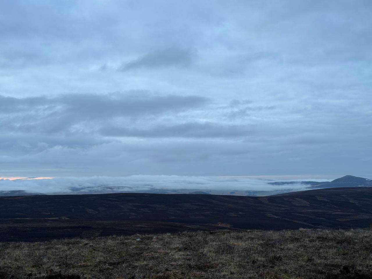
Ladylea Hill was incredibly quiet, a feature I really appreciated. It feels incredibly remote, with a long winding drive down Glenbuchat, which still has ice on the surface of the lochs and standing water.
A brooding summit crowned with grey cloud in fantastic scenery that only revealed itself upon the clouds blowing through:
I set up at the cairn and picked up 30 contacts overall, split between 40m and 20m, with some inter-g on 40 and a couple of continental surprises. 20 had longer skip today, so I saw Spain, Finland, Slovenia, Poland.
On teardown, I managed to snap the top segment of my brand new mast with my cold, clumsy fingers, but thankfully sotabeams stock replacements. More money at the problem, again.
Back to the car, no app needed, and homeward bound as the light faded.
At the end of the weekend, I find myself finally over 100 activator points and over 400 chaser points. Somehow I’ve collected more points this year already than last year, the winter bonuses really do stack up!
Addendum - OSMAnd & Open Street Map
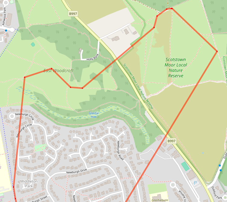
I’ve been using OSMAnd on my iPhone quite extensively recently, I think offline mapping is super important if you’re going out to get mildly lost in the hills. On more than one occasion, I have confidently set off in the wrong direction in the mist, and maps have saved my bacon!
As you can download .gpx files, it’s great to have them on the device and available for guidance in case you get lost, coupled with an offline map. Plus, as I drive around I love to have the dark red of a hill I’ve walked appear on the map in my car dash or in my hand:
This weekend I discovered it’s possible to have height maps for nice 3d maps and contours marked on the map - you just need to download some additions for the maps. This is a really nice feature, it makes maps more pretty and more useful when you’re in the middle of nowhere.
Open Street Map also has designators for SOTA summits here and similar for POTA here
GM5ALX has set to adding the summits around Scotland here.
While the benefits aren’t immediately obvious, it allows developers of mapping applications access to more data at no extra cost, really. It helps add depth to an already rich set of information, and allows us as radio amateurs to do more interesting things with maps and not be shackled to Apple/Google.
Because it’s open data, we can also fix things we find wrong as users. I like to fix road surfaces after I’ve been cycling as that will feed forward to route planning through Komoot and data on my wahoo too, which can be modified with osm maps.
In the future, it’s possible to have an OSMAnd plugin highlighting local SOTA summits or mimicking features of sotl.as but offline.
It’s cool to be able to put open technologies to use like this in the field and really is the convergence point of all my favourite things!